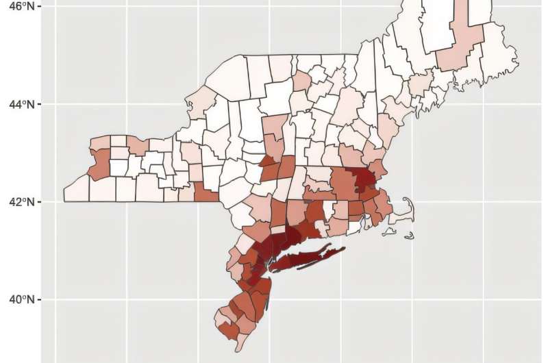
Mosquito surveillance for WNV is a central component of the public health response, but this approach is labor intensive and limited by practical constraints on the number of locations that can be sampled.
To address this limitation, Joseph McMillan and colleagues developed a validated machine learning model that uses freely available weather, land cover, and demographic data in combination with mosquito surveillance data from the state of Connecticut from 2001 to 2020 to predict the risk of WNV to humans in areas of the Northeast U.S. with and without mosquito surveillance operations. Their research is published in PNAS Nexus.
Variables found to be predictive of WNV risk in the region include a mix of high temperature and precipitation during the current and prior months, current and prior drought conditions, high human population density, and the prevalence of urbanized land cover.